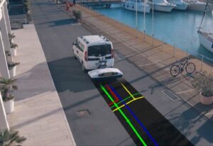
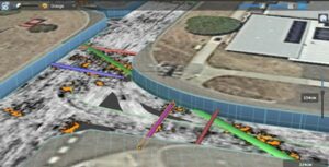
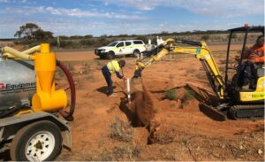
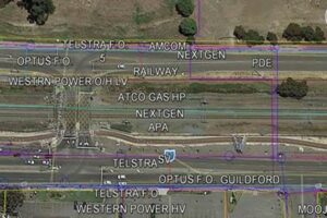
BCE Spatial’s Geo Radar capabilities offer clients the quickest and most accurate means of identifying, imaging and cataloguing underground utilities and assets.
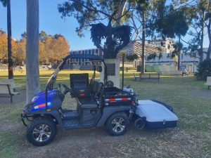
The BCE Spatial team can collect comprehensive utility models that can be exported as 3D CAD models. We use multi-frequency, multi channel technology that fully scans the ground that can be hand held or vehicle mounted.
With DBYD (Dial before you dig) certified operators we can locate underground utilities to AS548.