Specialising in providing innovative solutions to all aspects of Civil Construction Surveying, SMP, Machine Guidance, Investigation Surveys, Terrestrial Scanning, Mobile Laser Scanning and Utility and 3D Subsurface mapping services.
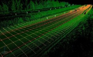
BCE run the Trimble MX8 and MX9 which are premium survey grade mobile laser imaging systems capturing fully synchronised, high-quality georeferenced point clouds and high-resolution imagery.
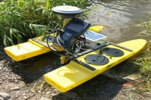
Additionally BCE also runs the IDS GeoRadar System which is a mobile GPR system (CART) capturing subsurface artefacts as high-resolution imagery similar to a CAT scan of the ground.
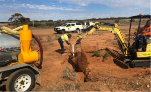
Within the company is a Major projects division, which can mobilise fully equipped surveyors to regional or remote locations to carry out all types of surveying projects, including bulk earthwork’s, civil works, structural steel placement and civil infrastructure works. Expertise in GPS and millimetre machine grade control for road construction projects is also available.
Our philosophy is to provide a high level of service and value to all our clients. We work with you to solve problems and limit risks though the implementation of the latest technology and experienced staff. We pride ourselves in taking the time to understand each clients needs to determine and then tailor the best solution for each project.